Boquillas Canyon
Big Bend National Park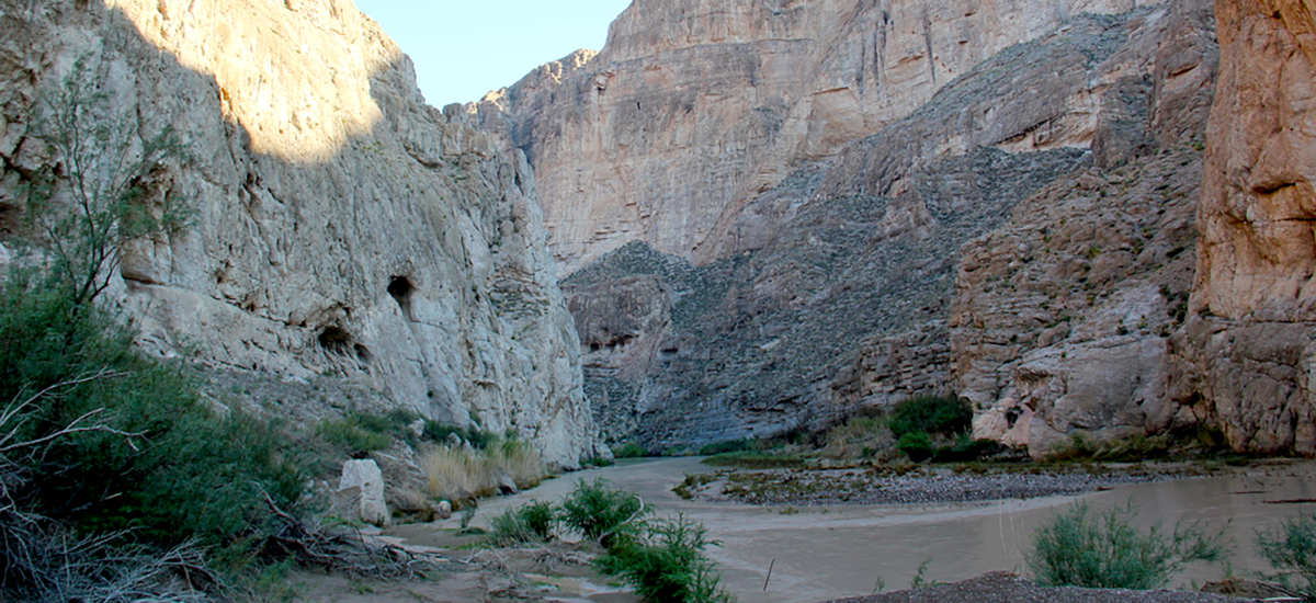
Boquillas means “little mouths” in Spanish. Although no one is sure where the name of the the canyon originated some believe it was named either for the canyon’s narrow entrance or for the numerous small openings, or solution holes, in its limestone walls. The Boquillas Canyon Trail is a popular short trail, appropriate for adults and children. Be aware, however, that during late spring, summer, and early fall midday temperatures frequently rise above 100 degrees F. During the hot time of year, walks along this trail are best taken in the early-morning hours.
The route is lined with typical Chihuahuan Desert vegetation such as creosote bush, lechuguilla, leather stem, ocotillo, and several varieties of prickly pear cactus. The trail splits, if you go to the right, you will skirt a small high hill and descend toward the river. Chose the left-hand path to climb up a slight rise and discover an excellent view of the Rio Grande and the entrance to Boquillas Canyon. Looking west from here, you can see the village of Boquillas, Mexico, across the river. About 175 people inhabit the former mining town.
The short left-hand trail rejoins the main trail a bit down the hill via a series of steep log steps. The trail takes you down about 90 feet to the banks of the Rio Grande. Upon reaching the river level, the main trail turns to the left (east). Walk west for about 50 feet and you will find yourself on a rock ledge in which there are several mortar holes made by prehistoric people who once lived in the area. Mortal holes like these; used for grinding seeds, roots, and pods can be found throughout Big Bend.
Returning to the main trail, you parallel the river and with through tunnels of river cane, primarily nonnative giant reed. Some of the smaller, native common reed is mixed in. This section of the trail can be washed out and impassible at times due to river flooding, in the summer and early fall.
The trail opens up to a large rocky beach at the edge of the Rio Grande in the entrance to this magnificent limestone canyon. Directly ahead, notice the fault line in the limestone cliff on the Mexican side of the river; it is obvious where the left-hand side of the fault dropped in relation to the right side.
A huge slide heaped up against the canyon wall is on the American side. Down-canyon winds created it by piling loose sand against the rocks. The slide is fun to climb, but quite strenuous. A shallow cave in the canyon wall tops the slide. Down-stream of the rocky beach, further travel stops where the river cuts off the beach and flows against the canyon wall. To return to the trailhead, retrace your steps.