South Rim
Big Bend National Park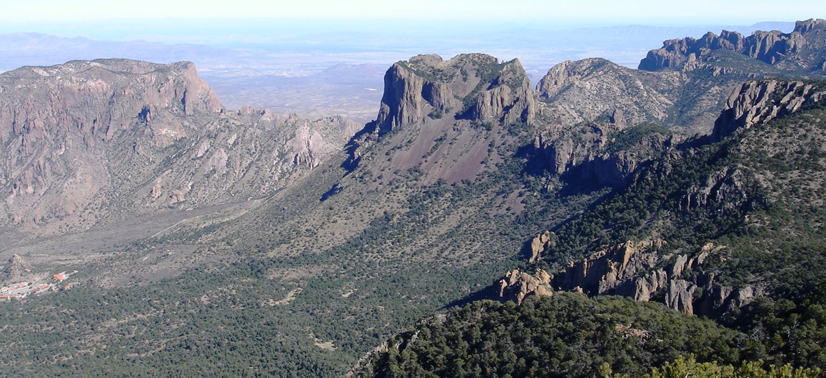
The Pinnacles Trail climbs into the Chisos Mountains to the South Rim, a sheer escarpment on the south side of the high section of the mountains. Views, encompass thousands of square miles of desert and mountains, making this one of the most impressive hikes in the park.
From the Basin, Pinnacles Trail climbs steeply through oaks, pines, junipers, and madrone trees to a high saddle between Toll Mountain and Emory Peak. At this pas, the trail levels out. From here, spectacular views of the Basin, the Window, and the desert far to the west attract the eye. Sadly, recent drought years, particularly the dry 2011, killed many of the pinyon pines in the Chisos Mountains. The park estimates that about 25 percent of the pinyons died during the drought.
The junction with Emory Peak trail lies right by the saddle; bear left unless you want to climb Emory Peak. The right-hand trail leads to the summit of Emory Peak, the highest point in the Chisos Mountains. It climbs steeply and requires a bit of rock scrambling at the end. Sheer, vertigo- inducing cliffs drop off from the summit on several sides. Views from the summit cover 360 degrees and encompass almost the entire park and far beyond. It’s a very worthwhile side trip, but be careful on the exposed summit. If you climb Emory Peak, return by the same spur trail to continue toward the South Rim on the main trail. The trail mileages listed do not include the spur trip to Emory Peak.
The Pinnacles Trail is often called the Boot Canyon or Boot Spring Trail after the junction with Emory Peak Trail. It winds through Boot Canyon, so named because of a large prominent rock formation shaped like an upside-down cowboy boot. The only spring i the high Chisos Mountains that provides enough water to be useful to humans lies in Boot Canyon, but it flows intermittently. Do not rely on obtaining water from Boot Spring.
The South Rim is one of the most scenic areas of the park; vast stretches of Chihuahuan Desert sweep south from the mountain foothills 2500 vertical feet below. The Rio Grande, almost a vertical mile below and far to the south, and the mountains in Mexico are visible on a clear day. Because of this tremendous panorama, the South Rim draws many hikers and backpackers.
Be sure to carry plenty of warm, dry clothing, even in the summer; thunderstorms can make it quite cool and wet. Although winters are generally mild, occasional storms bring snow and cold temperatures to the high mountains traversed by this trail.